Choose a resource
8 items
| Title | Type |
|---|---|
| Hawaiʻi Historical Tsunami Effects (1812–2022) | Historical poster · PDF |
| Hawaiʻi Tsunami Compendium | Reference · PDF |
| July 29, 2025: An Actual Tsunami Warning | Historical bulletin |
| The 1946 Hilo Tsunami in Photographs | Photo gallery |
| Hilo Tsunami Survivors Tell Their Stories | Study & survivor accounts |
| Go Up, Not Out: A Honolulu Tsunami Safety Report | Report · PDF |
| University of Hawaiʻi Tsunami Preparedness | Video |
| When the Warning Comes | Workshop in development |
Select a title to open it.
HAWAIʻI TSUNAMI HISTORY · 1812–2022
Hawaiʻi Historical Tsunami Effects
Explore two centuries of Hawaiʻi’s tsunami history through Pacific source maps, island observations and historical photographs. This detailed poster brings together tsunami travel times, recorded effects and accounts of major events.
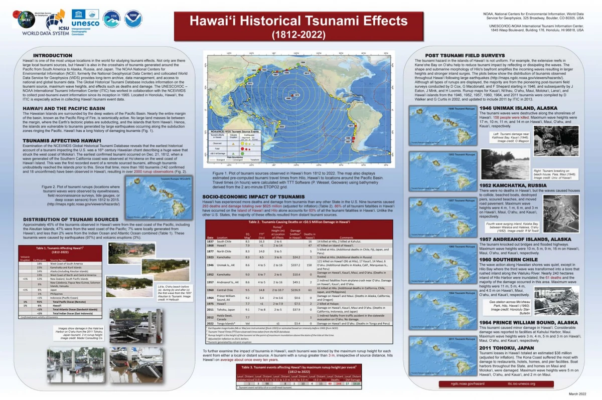
Source: NOAA National Centers for Environmental Information, World Data Service for Geophysics; UNESCO/IOC–NOAA International Tsunami Information Center. Original poster and credits preserved. View the NOAA-hosted original.
Historical coverage: 1812–2022. For current tsunami information, visit Tsunami.gov.
FREE WEB EDITION · PREPAREDNESS REFERENCE
Hawaiʻi Tsunami Operational Compendium & Source Register
The research behind Four Hours to Impact, freely available to read, download, and share.
How Hawaiʻi detects a distant tsunami, decides to warn, and moves four counties out of the water—drawn from 205 federal, state, county, and scientific sources spanning 1947–2026.
A reference for planners, responders, journalists, students, and anyone who wants to understand the warning.
Free to download and share. No email or account required.
HISTORICAL DOCUMENT · JULY 29, 2025
July 29, 2025: An Actual Tsunami Warning
This saved National Weather Service page contains Tsunami Message Number 3, issued by the Pacific Tsunami Warning Center in Honolulu at 2:43 p.m. HST on July 29, 2025. It placed the State of Hawaiʻi under a tsunami warning following an earthquake off the east coast of Kamchatka, Russia.
The same PDF includes Tsunami Message Number 2 from the National Tsunami Warning Center in Palmer, Alaska, issued at 5:19 p.m. PDT that day, for coastal areas from Samalga Pass to Attu. The original wording and preliminary information are preserved as issued.
Original, unaltered PDF · 1 page · 118 KB
THE HISTORY BEHIND THE QUESTIONS · APRIL 1, 1946
When the tsunami reached Hilo.
Real people. Familiar streets. A morning that changed everything.
April 1, 1946 · Magnitude 8.6 · Aleutian Islands, Alaska
An earthquake near Alaska’s Aleutian Islands sent a devastating tsunami across the Pacific. Close to its source, on Unimak Island, the water reached more than 100 feet above sea level and destroyed the U.S. Coast Guard’s reinforced-concrete Scotch Cap lighthouse. All five crew members died.
For communities near the earthquake, the tsunami was a local disaster with little time to react. For Hilo, thousands of miles away, it was a distant threat: the waves arrived approximately 4.9 hours later. Ninety-six people lost their lives in Hilo. Across Hawaiʻi, property damage totaled approximately $26 million in 1946 dollars.
There was no tsunami warning center in 1946. The disaster helped spur the development of a U.S. tsunami warning system and underscored a lesson that still matters: recognizing natural warning signs and knowing how to respond can save lives.
These historical photographs bring the human stakes into view. They give readers of Four Hours to Impact a connection to Hawaiʻi’s real tsunami history and the questions the novel explores: how people recognize danger, make decisions, and look after one another.
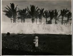
A wave at the beachfront
A breaking wave fills the shoreline beneath a row of palms.
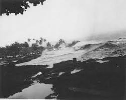
The surge along the shore
Water surges across the low shoreline, with palms visible in the distance.
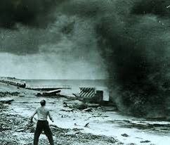
At the waterfront
A person stands near the waterfront as water and spray rise beside the structures.
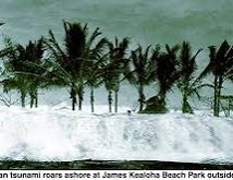
Palms and whitewater
An incoming wave reaches the palm-lined beachfront. The caption on this supplied copy is retained.
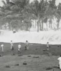
People at the shore
People in the foreground, with breaking water behind them—a reminder of the human scale of the disaster.
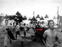
Running through downtown Hilo
People run through Hilo during the tsunami. The Pacific Tsunami Museum identifies the photographer as Cecilio Licos and the young man at right as George Wong.
Photo: Cecilio Licos. Read George Wong’s story at the Pacific Tsunami Museum.
Photograph source: UNESCO’s Intergovernmental Oceanographic Commission (IOC) / International Tsunami Information Center, as identified by Jerry Perone, who supplied these copies. Original photographer credits are retained where identified.
Historical sources: Adapted from UNESCO–IOC’s account of the April 1, 1946 tsunami. Hilo fatalities and the Hawaiʻi-wide property-damage estimate are documented in NOAA’s historical tsunami records. NOAA’s historical overview describes the disaster’s role in the development of tsunami warnings.
Explore more history and survivor accounts at the Pacific Tsunami Museum, or return to Four Hours to Impact.
HILO TSUNAMI HISTORY · SURVIVOR ACCOUNTS
Hilo Tsunami Survivors Tell Their Stories
What do people hear, believe, and do when a tsunami warning arrives? This master’s thesis examines interviews with survivors of Hilo’s 1946 and 1960 tsunamis, emergency-agency logs, and community awareness. Their accounts bring the human decisions behind these disasters into focus and show why clear warnings and continuing public education matter.
Personal Accounts from Survivors of the Hilo Tsunamis of 1946 and 1960: Toward a Disaster Communication Model
Historical research · 151-page scanned PDF · 3.9 MB
NEW ENGINEERING PUBLIC-SAFETY REPORT
Go Up, Not Out: A Honolulu Tsunami Safety Report
When a tsunami warning sent traffic through Kakaʻako, some high-rise residents drove away from the elevation they already had. Jerry Perone’s 22-page report examines that choice and the congestion it can create for people who must evacuate. It proposes a practical way for officials and building managers to explain when a verified high-rise offers a safe route upward. Residents, neighbors, and decision-makers should read it before the next warning so the right instruction reaches the right people.
The recommendation is conditional: building suitability, the active evacuation zone, the building’s plan, and official instructions determine what to do.
ONE COMPLETE DOWNLOAD
Understand the warning.
Explore Hawaiʻi tsunami evacuation, the tsunami warning process in Hawaii, and the emergency-management decisions that connect detection to action.
- Operational Compendium: the reference material behind the novel’s warning and response setting. Read from PDF page 2.
- Full Source Register: the federal, state, county, and scientific sources gathered for the research. Read from PDF page 125.
- About / free to share: the complete edition includes its original cover and closing author and reference page. Read PDF page 176.
Compiled 25 August 2026. The register explains its verification flags: entries marked “unverified” were confirmed by citation but could not be obtained directly at compilation. Obtain those originals before formal quotation. Source links and official guidance can change.
Explore Four Hours to Impact · When the Warning Comes workshops